 World rankers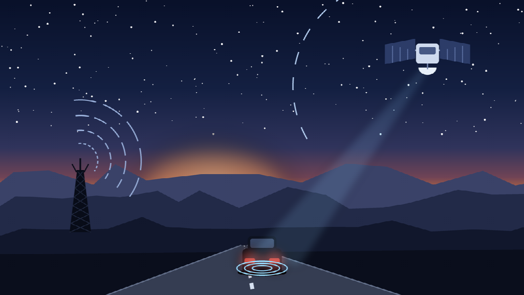
Coverage maps are optimistic documents. They are drawn to show what is theoretically possible under good conditions, which is not the same as what your phone does when you are in a canyon, under heavy tree cover, or forty miles down a county road with a ridge between you and the nearest tower.
Anyone who drives outside metro areas regularly has already discovered this. Service crews working rural routes, contractors on remote sites, people towing to trailheads and boat ramps, freight drivers on secondary highways, and anyone who has taken a road trip through the mountain West all know the specific feeling of watching the bars disappear and realizing the navigation app has stopped updating.
Most of the time this is a minor annoyance. Occasionally it is the difference between a bad afternoon and a genuinely dangerous situation. The planning worth doing sits in between, and it is more practical than most preparedness advice suggests.
Coverage fails by terrain, not by distance
The intuitive model is that coverage gets worse the farther you get from cities. That is roughly true and also misleading.
Cellular signal is line of sight in practice. A ridge, a deep valley, a dense stand of trees, or a steep grade can drop you to nothing while a town sits twelve miles away. Meanwhile you can find perfectly good service in genuinely remote flat country because a single tower covers an enormous area with nothing to block it.
This matters because it means coverage gaps are not where you expect them. They are not a smooth gradient from city to wilderness. They are pockets, and they are frequently in exactly the places where a road is narrow, steep, and least forgiving.
The practical takeaway: do not assume you will have service simply because you are not that far out. Assume the opposite on any route with real topography.
Your phone is not a plan
Phones are excellent until they are not. The failure modes stack up quickly.
Battery drains faster in low coverage, because the radio increases power output hunting for a tower. Cold weather cuts capacity further. Screens crack. Phones get left on the roof of the truck at a gas station, which happens more often than anyone admits. And a phone in your pocket tells you nothing about your vehicle if you and the vehicle become separated, which is the scenario in a breakdown, a rollover on a forest road, or a theft from a trailhead lot.
None of that argues against carrying a phone. It argues against a plan where the phone is the only layer. Redundancy is the entire point of preparation, and the useful version separates cleanly into three questions.
Layer one: where is the vehicle
The baseline layer answers the simplest question, and it answers it whether or not anyone is in the vehicle.
For most drivers this means a small cellular tracking device installed in the vehicle, reporting position on an interval. It is genuinely useful for mundane reasons long before anything goes wrong: knowing whether a crew truck actually reached the site, confirming a delivery time, settling a disagreement about arrival, tracking mileage for reimbursement without anyone filling in a log by hand.
Installation choice matters more than brand for most people. Plug-in devices that use the diagnostic port take about thirty seconds and can be moved between vehicles, which suits anyone rotating equipment. Hardwired installs take under an hour, cannot be casually unplugged, and are the right call for a vehicle that stays in service. Battery and solar units suit trailers, campers, and anything without a constant power source. Battery life on those varies enormously with reporting frequency, and it is the specification most worth checking before buying, since a device reporting every five minutes might last weeks while the same device reporting hourly lasts years.
For remote driving specifically, one setting deserves attention: how the device behaves when it loses signal. Better units store position data locally while out of coverage and upload the full track once they reconnect, rather than simply leaving a gap. That stored history is what lets someone reconstruct where a vehicle went during the hours it was dark.
Layer two: what actually happened
Location data is a series of dots. It cannot tell you why the vehicle stopped, who was driving, or what the other car did.
A gps tracker dash cam fills that gap by pairing continuous video with position and speed. On remote roads, that combination is more useful than either half alone. Wildlife strikes, which are dramatically more common on rural routes at dawn and dusk, become documented rather than disputed. Single-vehicle incidents on gravel and washboard get a record. Encounters with commercial traffic on narrow roads, where the argument afterward is always about who was over the center line, stop being a matter of competing memory.
There is a second, quieter benefit. Footage recorded in the minutes before a breakdown often shows what caused it. A rock strike, a piece of debris, a sudden temperature warning on the dash. That helps a mechanic and it helps a claim.
Storage is the practical constraint. Loop recording overwrites older footage continuously, so anything worth keeping needs to be locked or exported reasonably soon. Build the habit of pulling a clip the same day rather than remembering it three weeks later after it has been recorded over.
Layer three: coverage that does not depend on towers
The first two layers both assume a network exists. On genuinely remote routes, that assumption fails.
A satellite gps tracker removes the dependency by transmitting through a satellite constellation rather than ground infrastructure. Position updates keep flowing in places where cellular devices go silent, which for certain kinds of driving is the entire value proposition.
The tradeoffs are worth stating plainly rather than glossing over. Satellite hardware costs more. Monthly service costs more. Reporting intervals are typically longer, measured in tens of minutes rather than seconds, because satellite bandwidth is expensive and constrained. Devices need reasonably clear sky view, so a unit buried under a steel canopy will struggle.
Given all that, satellite is not a default recommendation. It makes sense for specific profiles: equipment stationed at remote sites for weeks, marine assets, backcountry and overlanding vehicles, freight moving through long stretches of nothing, and any high-value asset whose loss would be catastrophic rather than inconvenient. For a van that works a suburban service area, it is money spent on a problem that does not exist.
The reasonable middle path for a lot of drivers is a cellular device for daily visibility plus a separate satellite communicator carried personally, which handles the human safety side including two-way messaging and an emergency SOS function. Different tools, different jobs.
The habits that matter more than the hardware
Equipment is the easy part. The behavioral side does more work and costs nothing.
- Tell someone the route and the expected return time. This is the oldest advice in outdoor safety and it remains the single most effective thing you can do. Someone needs to know when to start worrying.
- Download offline maps before you leave. Navigation apps fail quietly at exactly the wrong moment. Cached map data for your region takes minutes to download.
- Fuel at half a tank, not at the light. Distances between stations stretch fast, and hours are shorter than you think in small towns.
- Carry water, warmth, and light for longer than you plan to be out. The most common remote-driving emergency is not a crash. It is an unplanned overnight.
- Check tire condition and carry a real spare. Gravel and washboard punish tires, and a compact spare is not built for forty miles of it.
- Know your vehicle’s recovery points. If you get stuck and someone stops to help, knowing where a strap can safely attach prevents a second, worse problem.
Bottom line
Remote driving is not dangerous in the way people imagine. It is dangerous in the way that small problems become large ones when help is far away and nobody knows where you are.
The fix is layered and mostly unglamorous: a device that reports the vehicle’s position, a camera that records what happened, an off-network option if your routes genuinely warrant it, and a person who knows when to expect you back.