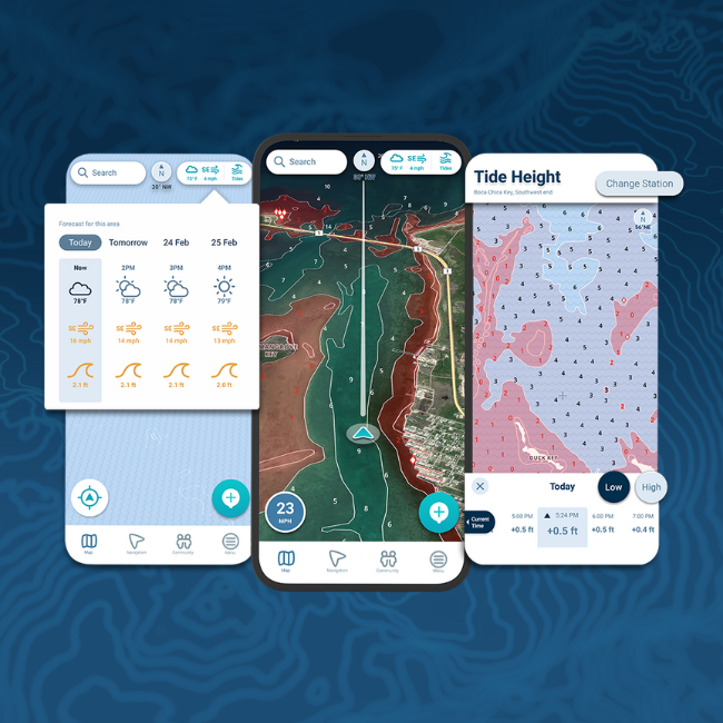
For sailors and anglers venturing into remote waters, reliable navigation is not a luxury—it’s a necessity. Many popular apps perform well near harbours or coastal zones, but their effectiveness drops in low-signal regions where cellular coverage is weak or nonexistent. Choosing from the top marine navigation apps can make all the difference between a safe passage and a risky gamble. Paired with resources like satellite communication systems, these apps ensure sailors maintain situational awareness even in the most isolated seas.
The Challenge of Navigating in Low-Signal Areas
Remote areas, such as open oceans, fjords, or isolated archipelagos, often lack reliable cell coverage. This creates a navigation gap for apps that depend solely on live data. Without offline charts or integration with onboard GPS systems, these tools can become nearly useless. That’s why sailors exploring remote waters must prioritise apps capable of functioning without constant internet access.
Key Features to Look For in Remote Navigation
Before evaluating which apps stand out, it’s worth identifying the most important features for low-signal conditions:
- Offline Chart Availability
The ability to download charts in advance is critical. Apps designed for offline use enable sailors to access detailed maps without an internet connection. - Integration with GPS
A strong app should work with onboard GPS rather than relying only on mobile signals. This ensures accurate positioning even in areas with weak signal strength. - Detailed Bathymetry
Precise depth contours help sailors avoid hazards such as shallow waters or reefs, especially in unfamiliar regions. - Tidal and Current Information
Having this data pre-downloaded adds another layer of safety when planning routes. - User-Friendly Interface
Remote sailing can be stressful. An intuitive interface ensures that information is accessible when quick decisions are necessary.

Popular Apps and How They Perform Offline
Navionics
Navionics is a favourite among sailors for its detailed charts and user-friendly app. Its strength in remote areas lies in its offline chart download feature, allowing users to store maps before heading offshore. The SonarChart™ layer is particularly useful for identifying underwater structures. However, its reliance on community edits is less helpful in low-signal zones where real-time sharing isn’t possible.
C-MAP
C-MAP excels in delivering high-resolution bathymetric charts, ideal for offshore sailors. Like Navionics, it allows for offline downloads, but its standout feature is custom depth shading, which provides clarity in waters where hazards might be less obvious. It’s highly compatible with multifunction displays, making it reliable even when the app itself is offline.
iNavX
iNavX is widely recognised for supporting a variety of chart formats, including NOAA raster charts. Its ability to function offline makes it a solid choice for remote use. The app also supports integration with onboard instruments, such as AIS, enhancing safety when connectivity is limited.
Aqua Map
Aqua Map has gained popularity due to its straightforward interface and reliable offline capabilities. It supports offline charts and even integrates with ActiveCaptain, though updates from this community-driven platform require internet access. For sailors who prioritise simplicity, it’s an effective option.
TimeZero
TimeZero is often chosen by professional mariners for its advanced charting and offline capabilities. Its routing features are powerful, and when paired with weather downloads before departure, it remains effective even in remote areas. Its main drawback is the learning curve, as it is more complex than most recreational apps.
Practical Scenarios Where Offline Apps Matter
- Ocean Crossings: A sailor crossing the Atlantic can’t rely on mobile data. Offline charts from Navionics or C-MAP become indispensable tools.
- Exploring Remote Islands: An angler heading to remote atolls may lose signal completely. Apps like iNavX ensure charts remain available and accurate.
- High-Latitude Sailing: In Arctic or Antarctic waters, where coverage is sparse, detailed offline bathymetry helps avoid hidden dangers under the ice.
Balancing Connectivity and Independence
Even the best apps cannot entirely replace hardware, such as dedicated chartplotters and satellite communication devices. Instead, they serve as powerful companions. The best approach is a hybrid one: download charts in advance, integrate the app with onboard GPS, and use satellite devices for weather updates or emergencies. This combination ensures a margin of safety even in signal blackouts.
Conclusion
In remote, low-signal areas, reliability is the top priority. Apps like Navionics, C-MAP, and iNavX stand out for their offline capabilities, detailed charts, and seamless GPS integration. Aqua Map and TimeZero also offer strong options depending on the sailor’s needs and level of expertise. Choosing from the top marine navigation apps ultimately comes down to preparation—downloading charts in advance, learning the interface, and pairing digital tools with dependable onboard systems. With the right setup, sailors can confidently navigate even the most isolated waters.
Read More Gorod


